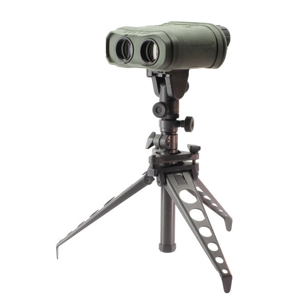

Ultra Long-Range Laser Rangefinder Binocular with GPS, Digital Compass & Tactical Data Integration
The LRB 12K by NEWCON OPTIK is an advanced MIL-SPEC laser rangefinder binocular engineered for military reconnaissance, surveillance, border security, artillery spotting, tactical observation, and long-range target acquisition missions. Designed to outperform conventional handheld rangefinder binoculars, the LRB 12K combines exceptional ranging capability, integrated navigation sensors, and tactical connectivity into a rugged field-ready platform.
Built for professional operators operating in demanding environments, the LRB 12K delivers precise distance measurements out to 12,000 meters on NATO-standard targets, with maximum reflective ranging capability extending up to 25,000 meters. Its integrated digital magnetic compass, inclinometer, and GPS receiver provide accurate azimuth, elevation, and coordinate data for target localization, fire correction, reconnaissance, and battlefield awareness.
The system features premium 7x42 binocular optics with fully multi-coated lenses, delivering bright and clear observation performance in both daylight and low-light conditions. A crystal-clear LED/OLED display overlays measurement data directly into the viewing field, enabling operators to rapidly gather and process tactical information without interrupting observation.
Designed as a complete battlefield observation and targeting solution, the LRB 12K supports advanced operational functions including first and last target logic, scan mode, speed detection, gating capability, object-to-object measurement, horizontal distance calculations, and target coordinate determination. The platform can also communicate with external ballistic computers, Android™ devices, CivTAK/ATAK systems, NC Cronus applications, and tactical command platforms through USB and RS-232 interfaces.
Constructed to MIL-STD-810G standards, the LRB 12K is designed for extreme operational conditions with shock-resistant, waterproof, and weather-resistant construction. The system operates reliably in temperatures ranging from -40°C to +60°C, making it suitable for deployment across desert, arctic, maritime, and high-altitude environments.
With its combination of long-range precision, tactical data integration, rugged durability, and professional-grade optics, the LRB 12K serves as a powerful force multiplier for modern military and security operations worldwide.